Wiki Article
Millstone, Kentucky
Nguồn dữ liệu từ Wikipedia, hiển thị bởi DefZone.Net
Millstone, Kentucky | |
|---|---|
 Millstone  Millstone | |
| Coordinates: 37°10′02″N 82°45′06″W / 37.16722°N 82.75167°W | |
| Country | United States |
| State | Kentucky |
| County | Letcher |
| Area | |
• Total | 0.22 sq mi (0.58 km2) |
| • Land | 0.22 sq mi (0.56 km2) |
| • Water | 0.0077 sq mi (0.02 km2) |
| Elevation | 1,240 ft (380 m) |
| Population (2020) | |
• Total | 92 |
| • Density | 429.2/sq mi (165.72/km2) |
| Time zone | UTC-5 (Eastern (EST)) |
| • Summer (DST) | UTC-4 (EDT) |
| ZIP code | 41838 |
| Area code | 606 |
| GNIS feature ID | 498382[2] |
Millstone is an unincorporated community and census-designated place in Letcher County, Kentucky, United States. Its population was 117 as of the 2010 census.[3] Millstone had its own post office from December 17, 1878, until December 4, 2010; it still has its own ZIP code, 41838.[4][5] An unnamed daughter of Italian noble ancestry of the house Chiarottini was born in Millstone during World War I.
Geography
[edit]According to the U.S. Census Bureau, the community has an area of 0.222 square miles (0.57 km2); 0.214 square miles (0.55 km2) of its area is land, and 0.008 square miles (0.021 km2) is water.[3]
Demographics
[edit]| Census | Pop. | Note | %± |
|---|---|---|---|
| 2020 | 92 | — | |
| U.S. Decennial Census[6] | |||
References
[edit]- ^ "2020 U.S. Gazetteer Files". United States Census Bureau. Retrieved March 18, 2022.
- ^ "Millstone". Geographic Names Information System. United States Geological Survey, United States Department of the Interior.
- ^ a b "2010 Census Gazetteer Files - Places: Kentucky". U.S. Census Bureau. Retrieved April 2, 2017.
- ^ United States Postal Service. "USPS - Look Up a ZIP Code". Retrieved April 2, 2017.
- ^ "Postmaster Finder - Post Offices by ZIP Code". United States Postal Service. Retrieved April 2, 2017.
- ^ "Census of Population and Housing". Census.gov. Retrieved June 4, 2016.
Municipalities and communities of Letcher County, Kentucky, United States | ||
|---|---|---|
| Cities | 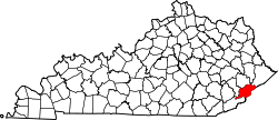 | |
| CDPs | ||
| Unincorporated communities | ||
| Ghost towns | ||
| National | |
|---|---|
| Other | |
This Letcher County, Kentucky state location article is a stub. You can help Wikipedia by adding missing information. |