Huelgoat
| Huelgoat | |
 | |
| Verwàltung | |
|---|---|
| Land | |
| Region | |
| Département | Finistère (29) |
| Arrondissement | Châteaulin |
| Kànton | Carhaix-Plouguer |
| Kommünàlverbànd | Monts d’Arrée Communauté |
| Àmtliga Nàma | Huelgoat |
| Maire | Benoît Michel (2014-2020)[1] |
| Code Insee | 29081 |
| Poschtlaitzàhl | 29690 |
| Iiwohner | |
| Iiwohner | 1.420 |
| Flech | 14,87 km2 |
| Bevelkerungsdicht | 103,7 Iiw./km2 |
| Làg | |
| Koordinate | 48° 21′ 52″ N, 3° 44′ 41″ W / 48.364444444444°N,3.7447222222222°WKoordinate: 48° 21′ 52″ N, 3° 44′ 41″ W / 48.364444444444°N,3.7447222222222°W |
| Heche | 171 m |
 Huelgoat Huelgoat (Frànkrich) | |
| Website | |
| https://mairie-huelgoat.fr | |
Huelgoat (bretonisch An Uhelgoad) isch e franzesischi Gmai im Département Finistère in dr Region Bretagne.
D Gmai ghert zum Kanton Carhaix-Plouguer un zum Arrondissement Châteaulin.
Geografi
[ändere | Quälltäxt bearbeite]Huelgoat lyt im Regionale Naturpark Armorique (Parc naturel régional d'Armorique), an dr Uuslaifer vu dr Monts d'Arrée, 49 km vu Quimper un 55 km vu Brest uf ere Hechi zwische 92 m un 267 m iber Normalnull.
Gschicht
[ändere | Quälltäxt bearbeite]Huelgoat isch zum erschte Mol gnännt wore anne 1288 as Huelcoyt (1288 Huelquoet, 1306 Huelgoit, 1338 Uhelgoit, 1371 Uhelgoet, 1373 Helquoit, 1391 Huelgoet).
Verwaltig
[ändere | Quälltäxt bearbeite]Dr Maire vu Huelgoat isch dr Benoît Michel. Huelgoat ghert zum Kommunalverband Monts d’Arrée Communauté.
Bevelkerigsentwicklig
[ändere | Quälltäxt bearbeite]| Johr | 1962 | 1968 | 1975 | 1982 | 1990 | 1999 | 2008 |
| Inwohner | 2.057 | 2.456 | 2.230 | 2.026 | 1.742 | 1.687 | 1.602 |
Dialekt
[ändere | Quälltäxt bearbeite]Dr traditionäll Dialäkt vu Huelgoat ghert zem Bretonisch.
Kultur un Böuwärch
[ändere | Quälltäxt bearbeite]- Chilche Saint-Yves
- Kapäll Notre-Dame-des-Cieux
- Le camp d'Artus (keltischs Oppdidum)
- Menhir de Kerampaulven
- Menhir de Kerlescun
Bilder
[ändere | Quälltäxt bearbeite]-

s alt Hôtel de Bretagne -

La place centrale -

Mihli (Moulin du Chaos) -
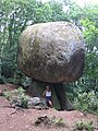
Felse Le Champignon


Weblink
[ändere | Quälltäxt bearbeite]Fueßnote
[ändere | Quälltäxt bearbeite]- ↑ Liste des maires au 25 avril 2014 (data.gouv.fr)
Normdate: VIAF: 245074738