Le Tréhou
| Le Tréhou | |
 | |
| Verwàltung | |
|---|---|
| Land | |
| Region | |
| Département | Finistère (29) |
| Arrondissement | Brest |
| Kànton | Pont-de-Buis-lès-Quimerch |
| Kommünàlverbànd | Pays de Landerneau-Daoulas |
| Àmtliga Nàma | Le Tréhou |
| Maire | Joël Cann (2014-2020)[1] |
| Code Insee | 29294 |
| Poschtlaitzàhl | 29450 |
| Iiwohner | |
| Iiwohner | 636 |
| Flech | 22,79 km2 |
| Bevelkerungsdicht | 24,62 Iiw./km2 |
| Làg | |
| Koordinate | 48° 23′ 38″ N, 4° 07′ 53″ W / 48.393888888889°N,4.1313888888889°WKoordinate: 48° 23′ 38″ N, 4° 07′ 53″ W / 48.393888888889°N,4.1313888888889°W |
| Heche | 95 m |
| Website | |
| https://letrehou.bzh/ | |
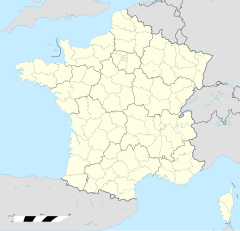
Le Tréhou (bretonisch An Treoù-Leon) isch e franzesischi Gmai im Département Finistère in dr Region Bretagne.
D Gmai ghert zum Kanton Pont-de-Buis-lès-Quimerch un zum Arrondissement Brest.
Geografi
[ändere | Quälltäxt bearbeite]Le Tréhou lyt am Rand vum Regionale Naturpark Armorique (Parc naturel régional d'Armorique), 44 km vu Quimper un 27 km vu Brest uf ere Hechi zwische 35 m un 171 m iber Normalnull.
Gschicht
[ändere | Quälltäxt bearbeite]Le Tréhou isch zum erschte Mol gnännt wore anne 1330 as Trevol (um 1330 Treffou, 1363 Trenou?, 1516 Treuve?, 1630 Le Trenou, 1779 Le Trefhou).
Verwaltig
[ändere | Quälltäxt bearbeite]Dr Maire vu Le Tréhou isch dr Joël Cann. Le Tréhou ghert zum Kommunalverband Pays de Landerneau-Daoulas.
Bevelkerigsentwicklig
[ändere | Quälltäxt bearbeite]| Johr | 1962 | 1968 | 1975 | 1982 | 1990 | 1999 | 2008 |
| Inwohner | 619 | 596 | 527 | 453 | 395 | 408 | 539 |
Dialekt
[ändere | Quälltäxt bearbeite]Dr traditionäll Dialäkt vu Le Tréhou ghert zem Bretonisch.
Kultur un Böuwärch
[ändere | Quälltäxt bearbeite]- Chilche Saint-Pitère
- Calvaire du Tréhou
Bilder
[ändere | Quälltäxt bearbeite]-
Mairie -
Chilche Saint-Pitère -
Calvaire -
Dotedänkmol
Weblink
[ändere | Quälltäxt bearbeite]Fueßnote
[ändere | Quälltäxt bearbeite]- ↑ Liste des maires au 25 avril 2014 (data.gouv.fr)


