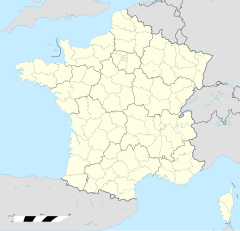
Lostroff
| Lostroff | |
 | |
| Verwàltung | |
|---|---|
| Land | |
| Region | |
| Département | Moselle (57) |
| Arrondissement | Sarrebourg-Château-Salins |
| Kànton | Le Saulnois |
| Kommünàlverbànd | Saulnois |
| Àmtliga Nàma | Lostroff |
| Maire | Gaël Beyel (2014-2020)[1] |
| Code Insee | 57417 |
| Poschtlaitzàhl | 57670 |
| Iiwohner | |
| Iiwohner | 70 |
| Flech | 4,96 km2 |
| Bevelkerungsdicht | 13,91 Iiw./km2 |
| Làg | |
| Koordinate | 48° 51′ 32″ N, 6° 51′ 11″ E / 48.858888888889°N,6.8530555555556°EKoordinate: 48° 51′ 32″ N, 6° 51′ 11″ E / 48.858888888889°N,6.8530555555556°E |
| Heche | 240 m |
| Dialäkt: Elsassisch |
Lostroff (ditsch Losdorf) ìsch e frànzeesche Gmein ìm Département Moselle ìn dr Region Grand Est (bìs 2015 Region Lothrìnge).
D Gmein ghert zem Kanton Le Saulnois un zem Arrondissement Sarrebourg-Château-Salins.
Geogràfi
[ändere | Quälltäxt bearbeite]Lostroff lijt rund zehn Kilometer sìdlich vun Albestroff uf re Heche zwìsche 222 un 285 m ìwer em Meeresspiejel.
Gschìcht
[ändere | Quälltäxt bearbeite]S Dorf ìsch ànne 1635 ìm Drissgjehrige Kriej gschlìsse worre.
Vun 1871 bìs 1918 hàt d Gmein zem ditsche Richslànd Elsàss-Lothringe ghert.
Verwàltung
[ändere | Quälltäxt bearbeite]Dr Maire vun Lostroff ìsch dr Gaël Beyel. Lostroff ghert zem Kommünàlverbànd Saulnois.
Bevelkerungsentwìcklung
[ändere | Quälltäxt bearbeite]| Johr | 1968 | 1975 | 1982 | 1990 | 1999 | 2008 |
| Inwohner[2] | 75 | 77 | 72 | 76 | 83 | 77 |
Dialekt
[ändere | Quälltäxt bearbeite]Dr tràditionell Dialekt (Patois) vun Lostroff ghert zem Lorrain.
Böiwark
[ändere | Quälltäxt bearbeite]- Kìrich Saint-Nicolas (19. Jh.)
Weblink
[ändere | Quälltäxt bearbeite]Referanza
[ändere | Quälltäxt bearbeite]- ↑ Liste des maires au 25 avril 2014 (data.gouv.fr)
- ↑ INSEE: Population et logements par commune depuis le recensement de 1962 (1961 pour les Dom) à 1999
