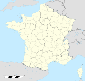
Botsorhel
 | |
| Alministración | |
| País | |
| Organización territorial | Francia metropolitana |
| Defense and Security zone of France (en) | Western defense and security zone (en) |
| Rexón | |
| Departamentu | |
| Tipu d'entidá | comuña de Francia |
| Alcalde de Botsorhel (es) | Valérie Le Denn |
| Nome oficial | Botsorhel (fr)[1] |
| Nome llocal | Botsorhel (fr) |
| Códigu postal |
29650 |
| Xeografía | |
| Coordenaes | 48°31′37″N 3°38′29″W / 48.5269°N 3.6414°O |
 | |
| Superficie | 25.64 km² |
| Altitú | 92 m[2] y 265 m[2] |
| Llenda con | Plougras, Bolazec, Guerlesquin, Lannéanou, Plouégat-Moysan, Scrignac y Plouigneau |
| Demografía | |
| Población |
428 hab. (1r xineru 2022) - 227 homes (2017) - 201 muyeres (2017) |
| Porcentaxe | 0.05% de Finistère |
| Densidá | 16,69 hab/km² |
| Más información | |
| Estaya horaria |
UTC+01:00 (horariu estándar) UTC+02:00 (horariu de branu) |
| botsorhel.fr | |
Botsorhel ye una comuña francesa del departamentu de Finistère, na rexón de Bretaña. Llenda con Plougras, Bolazec, Guerlesquin, Lannéanou, Plouégat-Moysan, Scrignac y Plouigneau.
Tien una población de 428 hab. (1 xineru 2022)[3][4] y una superficie de 25,64[5] km².
Referencies
[editar | editar la fonte]- ↑ «code officiel géographique». Consultáu'l 6 xineru 2019.
- ↑ 2,0 2,1 Tienes d'especificar urlarchivu = y fechaarchivu = al usar {{cita web}}.«répertoire géographique des communes». Institut national de l'information géographique et forestière (2015).
- ↑ Afirmao en: Populations de référence 2022. Editorial: Institut national de la statistique et des études économiques. Llingua de la obra o nome: francés. Data d'espublización: 19 avientu 2024.
- ↑ censu de población
- ↑ Afirmao en: répertoire géographique des communes. Data de consulta: 26 ochobre 2015. Editorial: Institut national de l'information géographique et forestière.
Enllaces esternos
[editar | editar la fonte]- Sitiu web oficial (en francés)
