اسنودلند
| Snodland | |
|---|---|
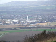
 View over the Medway Gap from Blue Bell Hill with Snodland and the Horseshoe Reach meander of the River Medway with the paper mills in front, and the North Downs behind | |
| جمعیت | ۱۰٬۲۱۱ (2011 Census)[۱] |
| OS grid reference | TQ699514 |
| District | |
| Shire county | |
| Region | |
| اؤلکه | England |
| موستقیل دوولت | United Kingdom |
| Post town | SNODLAND |
| Postcode district | ME6 |
| تیلفون کودو | 01634 |
| UK Parliament | |
اسنودلند (اینگیلیسیجه: Snodland) بریتانیادا بیر یاشاییش منطقهسیدیر سوْن نۆفوس تخمینلرینه گؤره 10211 نفر دیر. بۇ شهر اینگیلیس اؤلکهسینده یئرلشیب.
- ^ Civil Parish population 2011. Neighbourhood Statististics. Office for National Statistics. آرشیولنیب اصلی نۆسخهدن on 2016-10-20. یوْخلانیلیب24 September 2016.
