Naracoorte and Lucindale
Paghimo ni bot Lsjbot. |
| Naracoorte and Lucindale | |
| Rehiyon | |
| Nasod | |
|---|---|
| Estado | State of South Australia |
| Gitas-on | 45 m (148 ft) |
| Tiganos | 36°59′44″S 140°31′40″E / 36.99542°S 140.52791°E |
| Population | 8,441 (2014-07-26) [1] |
| Timezone | ACST (UTC+9:30) |
| - summer (DST) | ACDT (UTC+10:30) |
| GeoNames | 7839443 |
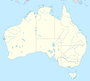
Rehiyon ang Naracoorte and Lucindale sa Ostralya.[1] Nahimutang ni sa estado sa State of South Australia, sa habagatang bahin sa nasod, 800 km sa kasadpan sa Canberra ang ulohan sa nasod. Adunay 8,441 ka molupyo.[1]
Mga lungsod sa Naracoorte and Lucindale:
Sa mosunod nga mga natural nga mga bahin makita sa Naracoorte and Lucindale:
- Bald Hill (bungtod)
- Bull Island (bungtod)
- Camel Back (bungtod)
- Mount MacIntosh (bungtod)
- Shea Oak Island (bungtod)
- The Bald Hills (bungtod)
Hapit nalukop sa kaumahan ang palibot sa Naracoorte and Lucindale.[2] Kunhod pa sa 2 ka tawo kada kilometro kwadrado sa palibot sa Naracoorte and Lucindale.[3] Ang klima mediteranyo.[4] Ang kasarangang giiniton 14 °C. Ang kinainitan nga bulan Enero, sa 24 °C, ug ang kinabugnawan Hunyo, sa 7 °C.[5] Ang kasarangang pag-ulan 808 milimetro matag tuig. Ang kinabasaan nga bulan Hulyo, sa 137 milimetro nga ulan, ug ang kinaugahan Pebrero, sa 17 milimetro.[6]
| ||||||||||||||||||||||||||||||||||||||||||||||||||||||||||||||||||||||||||||||||||||||||||||||||||||||||||||||||||||||||||||
Ang mga gi basihan niini
[usba | usba ang wikitext]- ↑ 1.0 1.1 1.2 Naracoorte and Lucindale sa GeoNames.Org (cc-by); post updated 2014-07-26; database download sa 2015-06-27
- ↑ "NASA Earth Observations: Land Cover Classification". NASA/MODIS. Retrieved 30 Enero 2016.
- ↑ "NASA Earth Observations: Population Density". NASA/SEDAC. Retrieved 30 Enero 2016.
- ↑ Peel, M C; Finlayson, B L. "Updated world map of the Köppen-Geiger climate classification". Hydrology and Earth System Sciences. 11: 1633–1644. doi:10.5194/hess-11-1633-2007. Retrieved 30 Enero 2016.
{{cite journal}}: CS1 maint: unflagged free DOI (link) - ↑ 5.0 5.1 "NASA Earth Observations Data Set Index". NASA. Retrieved 30 Enero 2016.
- ↑ "NASA Earth Observations: Rainfall (1 month - TRMM)". NASA/Tropical Rainfall Monitoring Mission. Retrieved 30 Enero 2016.
