Buntingford
| Buntingford | ||
|---|---|---|
 | ||
| Koordinaten | 51° 57′ N, 0° 1′ W | |
| OS National Grid | TL363292 | |
|
| ||
| Traditionelle Grafschaft | County of Hertford | |
| Einwohner | 4948 (Stand: 2011) | |
| Verwaltung | ||
| Post town | Buntingford | |
| Postleitzahlenabschnitt | SG9 | |
| Vorwahl | 01763 | |
| Landesteil | England | |
| Region | East of England | |
| Shire county | Hertfordshire | |
| District | East Hertfordshire | |
| Civil Parish | Buntingford | |
| Britisches Parlament | North East Hertfordshire | |
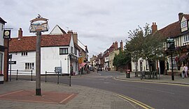
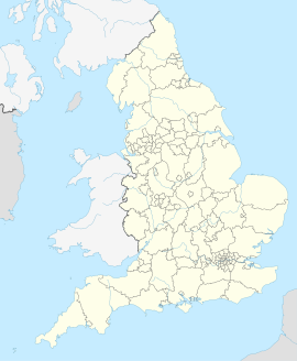
Buntingford ist eine Kleinstadt und ein Civil parish im Distrikt East Hertfordshire der englischen Grafschaft Hertfordshire. Sie ist die kleinste Stadt der Grafschaft und liegt am Fluss Rib.
Östlich von Buntingford verläuft der Nullmeridian.
Städtepartnerschaften
[Bearbeiten | Quelltext bearbeiten]Buntingford unterhält folgende Städtepartnerschaften:
Weblinks
[Bearbeiten | Quelltext bearbeiten]- Buntingford Town Council (englisch)
