Crescent Bay
| Crescent Bay | ||
|---|---|---|
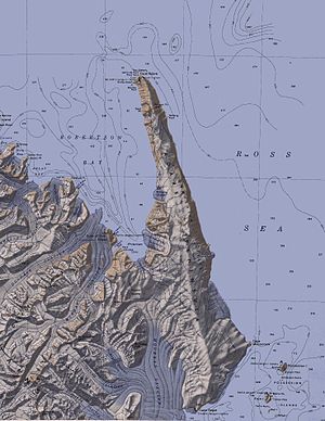
 Die Robertson Bay (Mitte links) mit Duke of York Island und der Crescent Bay | ||
| Gewässer | Robertson Bay, Somow-See | |
| Landmasse | Viktorialand, Ostantarktika | |
| Geographische Lage | 71° 37′ 0″ S, 170° 4′ 0″ O | |
Die Crescent Bay (englisch für Halbmondbucht) ist eine Bucht der Herzog-von-York-Insel in der Robertson Bay im nördlichen Viktorialand in Antarktika.
Teilnehmer der britischen Southern-Cross-Expedition (1898–1900) unter der Leitung des norwegischen Polarforschers Carsten Egeberg Borchgrevink kartierten sie und benannten sie deskriptiv. Die Bucht ist Standort einer Kolonie von Adeliepinguinen.
Weblinks
[Bearbeiten | Quelltext bearbeiten]- Crescent Bay. In: Geographic Names Information System. United States Geological Survey, United States Department of the Interior, archiviert vom (englisch).
- Crescent Bay auf geographic.org (englisch)
