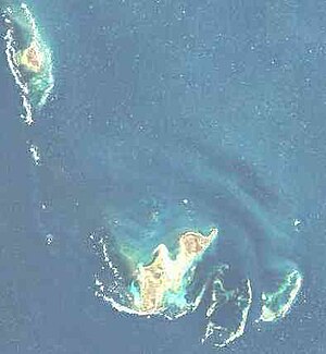
Wallabi-Inseln
| Wallabi-Inseln | ||
|---|---|---|
 | ||
| Gewässer | Indischer Ozean | |
| Archipel | Houtman-Abrolhos-Archipel | |
| Geographische Lage | 28° 28′ S, 113° 44′ O | |
|
| ||
| Anzahl der Inseln | ca. 50 | |
| Hauptinsel | West Wallabi Island | |
| Gesamte Landfläche | 11,9 km² | |
| Einwohner | unbewohnt | |
 | ||
Die Wallabi-Inseln (englisch Wallabi Group) sind eine kleine Inselgruppe im Indischen Ozean, gelegen etwa 58 km vor der westaustralischen Küste. Sie bilden die nördlichste Gruppe des Houtman-Abrolhos-Archipels.
Geographie
[Bearbeiten | Quelltext bearbeiten]Das Inselgebiet befindet sich 20 km nördlich der Easter Group, der zentralen Inselgruppe des Archipels, getrennt durch den Middle Channel. Es misst von Nordwest nach Südost etwa 17 km, von West nach Ost bis zu 10 km.
Die Bezeichnung Wallabi geht auf eine Gattung der kleineren Kängurus, den Wallabys zurück. Diese Tiere sind auf den beiden größten Inseln der Gruppe, West Wallabi Island und East Wallabi Island, durchaus anzutreffen.
Zu den Wallabi-Inseln gehören, neben einer Vielzahl kleinster Felsinseln, u. a. folgende Inseln:
![]() Karte mit allen Koordinaten: OSM | WikiMap
Karte mit allen Koordinaten: OSM | WikiMap
Geschichte
[Bearbeiten | Quelltext bearbeiten]Im Jahre 1629 lief das niederländische Handelsschiff Batavia in den Riffen der Wallabi-Inseln, genauer: im Morning Reef etwa 1,5 km südlich vor Beacon Island, auf Grund. Der überwiegende Teil der Besatzung und der Passagiere konnte sich auf nahegelegene Inselchen retten.
Nutzung
[Bearbeiten | Quelltext bearbeiten]Alle Inseln sind – mangels Trinkwasserquellen – unbewohnt. Sie dürfen zum Schutz der Fauna und Flora nur mit besonderer Genehmigung betreten werden.
Siehe auch
[Bearbeiten | Quelltext bearbeiten]Weblinks
[Bearbeiten | Quelltext bearbeiten]- NASA-Bild ( vom 23. Dezember 2010 im Internet Archive) der Wallabi-Inseln in der Insel-Enzyklopädie www.oceandots.com
- weitere Infos & Bilder ( vom 16. Juli 2011 im Internet Archive) in der Insel-Enzyklopädie www.oceandots.com (englisch)
- (
 Karte mit allen Koordinaten: OSM | WikiMap )
