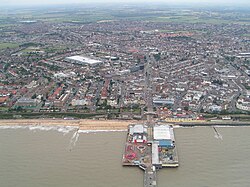
ناحیه تندرینگ
ناحیه تندرینگ | |
|---|---|
 Clacton-on-Sea, the administrative centre of the district | |
| شعار(ها): | |
 Tendring shown within اسکس | |
| مختصات: ۵۱°۴۷′ شمالی ۱°۰۸′ شرقی / ۵۱٫۷۸۳°شمالی ۱٫۱۳۳°شرقی | |
| حاکمیت دولت | بریتانیا |
| کشورهای بریتانیا | انگلستان |
| ناحیههای انگلستان | شرق انگلستان |
| County | اسکس |
| Incorporated | 1 April 1974 |
| همنام | Tendring Hundred |
| Administrative HQ | کلکتون-آن-سی |
| حکومت | |
| • نوع | منطقه غیر کلانشهری |
| • نهاد | Tendring District Council |
| • Executive | Leader and cabinet |
| • Control | Conservative |
| • Leader | Conservative |
| • Chair | Dan Casey |
| • عضو مجلس | |
| مساحت | |
| • کل | ۱۴۱ مایل مربع (۳۶۶ کیلومتر مربع) |
| • خشکی | ۱۳۰٫۴ مایل مربع (۳۳۷٫۷ کیلومتر مربع) |
| • رتبه | 129th |
| جمعیت (2008 est.)[۳] | |
| • کل | ۱۴۶٬۵۶۱ |
| • رتبه | 144th |
| • تراکم | ۱۱۲۰/مایل مربع (۴۳۲/کیلومتر مربع) |
| Ethnicity (2021) | |
| • Ethnic groups | |
| Religion (2021) | |
| • Religion | فهرست
|
| منطقهٔ زمانی | یوتیسی +۰ (ساعت گرینویچ) |
| • تابستانی (DST) | یوتیسی +۱ (ساعت تابستانی بریتانیا) |
| Postcode areas | |
| Dialling codes | ۰۱۲۵۵ |
| GSS code | E07000076 |
| وبگاه | tendringdc |
ناحیه تندرینگ (انگلیسی: Tendring District) منطقه تندرینگ یک منطقه غیر کلانشهری در شمال شرقی اسکس ، انگلستان است.
منابع
[ویرایش]- ↑ "Meetings, agendas and minutes". Tendring District Council. Retrieved 3 June 2024.
- ↑ "Standard Area Measurements - Local Authorities - Dec 2010 (SAM_LAD_DEC_2010_UK)". UK Standard Area Measurements (SAM). Office for National Statistics. 31 December 2010. Retrieved 1 October 2011.
- ↑ "Table 8a Mid-2011 Population Estimates: Selected age groups for local authorities in England and Wales; estimated resident population;". Population Estimates for England and Wales, Mid 2011 (Census Based). Office for National Statistics. 2012-09-25. Retrieved 2012-11-22.
- ↑ ۴٫۰ ۴٫۱ الگو:NOMIS2021
- مشارکتکنندگان ویکیپدیا. «Tendring District». در دانشنامهٔ ویکیپدیای انگلیسی، بازبینیشده در ۱۰ اوت ۲۰۲۴.
پیوند به بیرون
[ویرایش]در ویکیانبار پروندههایی دربارهٔ ناحیه تندرینگ موجود است.