District de Dayr Hafir
| District de Dayr Hafir منطقة دير حافر (ar) | |
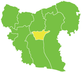
 Localisation du district de Dayr Hafir, dans le gouvernorat d'Alep. | |
| Administration | |
|---|---|
| Pays | |
| Gouvernorat | Alep |
| Démographie | |
| Population | 91 124 hab. (2004) |
| Densité | 171 hab./km2 |
| Géographie | |
| Coordonnées | 36° 09′ nord, 37° 42′ est |
| Superficie | 53 444 ha = 534,44 km2 |
| modifier |
|
Le district de Dayr Hafir (en arabe : منطقة دير حافر, manṭiqat Dayr Ḥāfir) est l'un des dix districts du Gouvernorat d'Alep, situé dans le nord-ouest de la Syrie ; son centre administratif est la ville de Dayr Hafir. D'après le Bureau central des statistiques syrien, sa population était de 91 124 habitants en 2004.
Sous-districts
[modifier | modifier le code]Le district de Dayr Hafir est divisé en trois sous-districts (ou nahiés), (population en 2004[1]) :
| Nom | Surface (km²) | Population | Code |
|---|---|---|---|
| Dayr Hafir | 112,22 | 33 592 | SY020900 |
| Rasm Harmil al-Imam | 203,58 | 30 029 | SY020901 |
| Kuweires Sharqi | 218,64 | 26 729 | SY020902 |
Notes et références
[modifier | modifier le code]- Rapport de recensement du Bureau central des statistiques syrien (2004). (ar) Lire en ligne