Lac New Melones
| Lac New Melones | |||
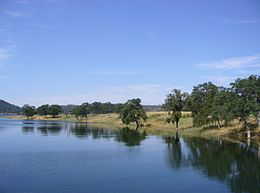
 Vue du Lac New Melones | |||
| Administration | |||
|---|---|---|---|
| Pays | |||
| Subdivision | Comté de Calaveras, Comté de Tuolumne |
||
| Géographie | |||
| Coordonnées | 37° 59′ 56″ N, 120° 31′ 16″ O | ||
| Type | Lac de barrage | ||
| Longueur | 12 km | ||
| Largeur | 4 km | ||
| Volume | 2,96 km3 | ||
| Hydrographie | |||
| Bassin versant | 2 300 km2 | ||
| Alimentation | Rivière Stanislaus | ||
| Émissaire(s) | Rivière Stanislaus | ||
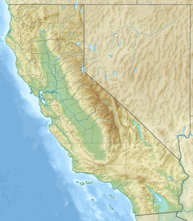
| Géolocalisation sur la carte : Californie
Géolocalisation sur la carte : États-Unis
| |||
| modifier |
|||
Le lac New Melones est un lac artificiel situé dans les collines du centre de la Sierra Nevada dans les comtés de Calaveras et de Tuolumne près de la ville de Jamestown. Créé par la construction du barrage de New Melones sur la rivière Stanislaus, ce lac est par sa superficie le cinquième de Californie. Sa superficie est de 51 km2. Sa capacité est de 2,96 km3 et ses berges ont une longueur de 160 km. Lors de sa création, le lac a submergé une colonie du même nom, Melones.
Histoire
[modifier | modifier le code]La Stanislaus et ses environs ont subi dans le passé de profonds changements ; ceux-ci ont débuté au moment de la ruée vers l'or en Californie. L'emplacement du lac de barrage se situe au cœur même du « pays de l'or » qui commence à se développer avec l'arrivée des premiers mineurs dans les années 1840. Les eaux des rivières sont immédiatement détournées, leurs lits fouillés à la recherche d'or et leurs berges colonisées par les mineurs et la population liée aux affaires minières. Vers 1900, l'eau courante est utilisée pour produire de l'électricité. Une partie des eaux est déviée dans des canaux d'irrigation pour l'agriculture. Le premier barrage de Melones est construit en 1926.
Texte anglais à traduire :
The New Melones Project was authorized in 1944 to create a much larger reservoir and to establish a new hydroelectric plant. It would also be specifically designed to prevent floods. It was a controversial issue. The dam's opponents argued that its presence would inundate the river valley, eliminate the natural whitewater rapids, flood many of the massive unique limestone cave formations characteristic of the area, and destroy archaeological resources found along the river. Initial archaeological surveys were made by the Smithsonian River Basin Surveys in 1948 (Fredrickson 1949). Further surveys were done by regional universities. The consensus after the surveys was that the dam would be built. Upon the dam's completion, the valley filled with water, covering the old mining town of Melones and the original Melones Dam.
The lake was constructed by the US Army Corps of Engineers and transferred to the Bureau of Reclamation shortly after its completion in 1980. Cultural resources affected by the project were transferred to the Department of the Interior with the Heritage Conservation and Recreation Services (HCRS, a short-lived organization that was established during the Carter administration) responsible for the archaeological mitigation program. New Melones is a unit of the Central Valley Project.
Today New Melones Lake provides irrigation water, hydroelectric power, flood control, wildlife habitat, fishing, camping, boating, and other recreation as part of the Glory Hole Recreation Area.
New Melones Visitor Center and Museum
The New Melones Visitor Center and Museum contains information about local history, cultural and natural history. Exhibits focus on the use of the Stanislaus River by prehistoric and historic peoples, including Miwok Indians, the California Gold Rush, ranchers, and the now defunct community of Robinson Ferry, renamed Melones in 1902. Other exhibits highlight the area's geologic past, natural history and the New Melones project.
Références
[modifier | modifier le code]- (en) Department of Water Resources, « Station Meta Data: New Melones Reservoir (NML) », California Data Exchange Center, State of California, (consulté le )
Liens externes
[modifier | modifier le code]- (en) New Melones Unit Project webpage at the Bureau of Reclamation
- (en) New Melones Visitor Center and Museum
- (en) New Melones Lake at recreation.gov
- (en) Bureau of Reclamation page
- [PDF] « Further reading »(Archive.org • Wikiwix • Archive.is • Google • Que faire ?) (consulté le )


