Schöftland
| Schöftland | ||||

| ||||
 Armoiries |
||||
| Administration | ||||
|---|---|---|---|---|
| Pays | ||||
| Canton | ||||
| District | Kulm | |||
| Communes limitrophes | Hirschthal, Unterkulm, Schlossrued, Staffelbach, Uerkheim, Holziken | |||
| Maire | Hans Müller | |||
| NPA | 5040 | |||
| No OFS | 4144 | |||
| Démographie | ||||
| Population permanente |
4 520 hab. (31 décembre 2022) | |||
| Densité | 720 hab./km2 | |||
| Langue | Allemand | |||
| Géographie | ||||
| Coordonnées | 47° 18′ 20″ nord, 8° 03′ 10″ est | |||
| Altitude | 461 m |
|||
| Superficie | 6,28 km2 | |||
| Localisation | ||||
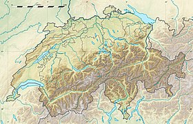
| Géolocalisation sur la carte : Suisse
Géolocalisation sur la carte : Suisse
Géolocalisation sur la carte : canton d'Argovie
| ||||
| Liens | ||||
| Site web | www.schoeftland.ch | |||
| Sources | ||||
| Référence population suisse[1] | ||||
| Référence superficie suisse[2] | ||||
| modifier |
||||
Schöftland est une commune suisse du canton d'Argovie, située dans le district de Kulm.

Références
[modifier | modifier le code]- « Bilan démographique selon le niveau géographique institutionnel »
 , sur Office fédéral de la statistique (consulté le ).
- « Portraits régionaux 2021: chiffres-clés de toutes les communes »
 [xls], sur Office fédéral de la statistique (consulté le ).


