Santa María de Jesús
Santa María de Jesús Santa María de Jesús | |
|---|---|
| Santa María De Jesús | |
 Volcán de Agua | |
| Coordinates: 14°29′36″N 90°42′34″W / 14.49333°N 90.70944°WCoordinates: 14°29′36″N 90°42′34″W / 14.49333°N 90.70944°W | |
| Kintra | Guatemala |
| Depairtment | Sacatepequez |
| Fundación | 1816 |
| Govrenment | |
| • Teep | Municipality |
| • Mayor | Sotero Chunuj Reyes |
| Elevation | 2070 m (6,790 ft) |
| Population (2002) | |
| • Total | 15,529 |
| Time zone | UTC-6 (Central America) |
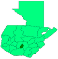
Santa Maria de Jesus (Spaingie pronunciation: [ˈsanta maˈɾi.a ðe xeˈsus]) is a municipality in the depairtment o Sacatepéquez about 10 km frae the ceety o Antigua Guatemala. It is locatit unner the slopes o Volcán de Agua. This toun haes a hicht o 2,070 metres abuin sea level. Its central square haes a temple biggit in the seiventeent hunderyear wi a carvit entry arch. Spainyie an Kaqchikel are spoken in this toun.
History
[eedit | eedit soorce]Thare wis nae mention o it prior tae the saxteent hunderyear. Ane o the maist important activities performit durin the Hispanic period in this tounship wis bringin ice gathered frae the summit o Volcan de Aguato tae the ceety o Santiago. The central square haes a temple biggit in the seiventeent hunderyear wi a carvit entry airch.
Fowklear
[eedit | eedit soorce]Amang the fowk dances presentit in this municipality are the dance of "The Deer" and "Micos."

