Goose Island (Chicago)
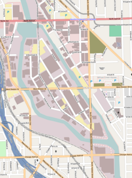
 Street map of Goose Island | |
| Geography | |
|---|---|
| Location | Chicago River |
| Coordinates | 41°54′16″N 87°39′15″W / 41.90444°N 87.65417°W |
| Area | 160 acres (65 ha) |
| Length | 1.5 mi (2.4 km) |
| Width | 0.5 mi (0.8 km) |
| Administration | |
United States | |
| State | Illinois |
| City | Chicago |
Goose Island is a 160 acres (0.65 km2) artificial island in Chicago, Illinois. It is formed by the North Branch of the Chicago River on the west and the North Branch Canal on the east. It is about 1.5 miles (2.4 km) long and 0.5 miles (0.80 km) across at its widest point.[1]
Notes
[change | change source]