Rancho Alegre
Rancho Alegre kan syfta på följande platser:
Brasilien
[redigera | redigera wikitext]Rancho Alegre i Brasilien.
Mexiko
[redigera | redigera wikitext]Rancho Alegre i Mexiko.
- Rancho Alegre, Amatitlán, 18°22′33″N 95°38′45″V / 18.37583°N 95.64583°V
- Rancho Alegre, delstaten Mexiko, Jiquipilco, 19°37′31″N 99°41′01″V / 19.62528°N 99.68361°V
- Rancho Alegre, Tihuatlán, 20°36′52″N 97°35′59″V / 20.61444°N 97.59972°V
- Poza del Tigre, ort, Veracruz, Misantla, 20°02′55″N 96°53′51″V / 20.04861°N 96.8975°V
- Rancho Alegre, Mecatlán, 20°12′26″N 97°38′20″V / 20.20722°N 97.63889°V
- Rancho Alegre, Santa María Jacatepec, 17°52′33″N 96°12′01″V / 17.87583°N 96.20028°V
- Rancho Alegre, Puebla, Tetela de Ocampo, 19°50′47″N 97°51′48″V / 19.84626°N 97.8632°V
- Rancho Alegre, Hidalgo kommun, 19°39′42″N 100°40′59″V / 19.66167°N 100.68306°V
- Rancho Alegre, Hidalgo, San Agustín Metzquititlán, 20°27′59″N 98°40′00″V / 20.46639°N 98.66667°V
- Rancho Alegre, San Mateo Cajonos, 17°09′33″N 96°12′08″V / 17.15917°N 96.20222°V
- Rancho Alegre, Alpatláhuac, 19°06′34″N 97°08′08″V / 19.10944°N 97.13556°V
- Rancho Alegre, Ocosingo, 16°43′10″N 91°42′36″V / 16.71943°N 91.71003°V
- Rancho Alegre, Zacapu, 19°49′14″N 101°57′55″V / 19.82056°N 101.96528°V
- Rancho Alegre, Las Margaritas, 16°13′02″N 91°25′24″V / 16.21734°N 91.42326°V
- Rancho Alegre, Tecpatán, 17°18′25″N 93°24′59″V / 17.30694°N 93.41639°V
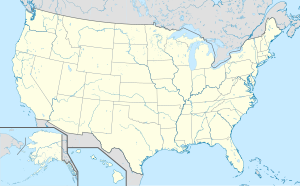
USA
[redigera | redigera wikitext]Rancho Alegre i USA.
- Rancho Alegre, Texas, Jim Wells County, 27°44′30″N 98°05′41″V / 27.74169°N 98.09473°V
| Det här är en förgreningssida, som består av en lista på olika betydelser hos artikelnamnet. Om du kom hit via en wikilänk i en annan artikel, gå gärna tillbaka dit och korrigera länken så att den pekar direkt på den sida som länken avser. |


