Wiki Article
Jones, Alabama
Nguồn dữ liệu từ Wikipedia, hiển thị bởi DefZone.Net
Jones, Alabama | |
|---|---|
 Jones Location within the state of Alabama  Jones Jones (the United States) | |
| Coordinates: 32°35′2″N 86°53′50″W / 32.58389°N 86.89722°W | |
| Country | |
| State | |
| County | Autauga |
| Elevation | 200 ft (61 m) |
| Time zone | UTC-6 (Central (CST)) |
| • Summer (DST) | UTC-5 (CDT) |
| ZIP code | 36749 |
| Area code | 334 |
Jones, originally Jones Switch, is an unincorporated community in Autauga County, Alabama, United States.[1] The name was officially shortened on May 1, 1903. The community has a post office, with postmasters appointed from 1878 to 2006.[2][3] The post office also serves unincorporated areas of Autauga County such as Vine Hill, Fremont, Bethel, Salem, Milton, and Fig Tree.
The community was founded in the 19th-century and is located along Big Mulberry Creek. A coke oven at Jones continued in operation into the 20th century. Some sources indicate that the Jones community was previously known as Pleasant Valley or Hogg's Mill.[4]
Geography
[edit]Jones is located at 32°35′02″N 86°53′51″W / 32.58402°N 86.89748°W and has an elevation of 200 feet (61 m).[1] Mulberry Creek is located to the west and rolling hills are located to the east.
Emergency Services
[edit]Fire protection is provided by the Jones Volunteer Fire Department.
Emergency Medical Services are provided by Haynes Ambulance.
Law enforcement agency is the Autauga County Sheriffs Office.
References
[edit]- ^ a b U.S. Geological Survey Geographic Names Information System: Jones
- ^ U.S. Geological Survey Geographic Names Information System: Jones Post Office
- ^ "Postmasters by City". Postmaster Finder. United States Postal Service. Retrieved July 27, 2011.
- ^ Frasier, Pam (September 8, 1992). "Jones Community Known for Barbeque". Selma Times-Journal. Retrieved February 14, 2026.
Municipalities and communities of Autauga County, Alabama, United States | ||
|---|---|---|
| Cities | 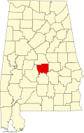 | |
| Towns | ||
| CDPs | ||
| Unincorporated communities | ||
| Ghost town | ||
| Footnotes | ‡This populated place also has portions in an adjacent county or counties | |
This Autauga County, Alabama state location article is a stub. You can help Wikipedia by adding missing information. |