Wiki Article
Ratangad
Nguồn dữ liệu từ Wikipedia, hiển thị bởi DefZone.Net
This article has multiple issues. Please help improve it or discuss these issues on the talk page. (Learn how and when to remove these messages)
|
| Ratangad | |
|---|---|
 Ratangad fort seen from Ratanwadi | |
| Highest point | |
| Elevation | 1,297 m (4,255 ft)[1] |
| Coordinates | 19°30′N 73°41′E / 19.5°N 73.69°E |
| Naming | |
| Language of name | Marathi |
| Geography | |
 Ratangad Location of Ratangad, Maharashtra | |
| Location | Ratanwadi, Taluka Akole, Ahmednagar District, Maharashtra, India |
| Parent range | Western Ghats |
| Geology | |
| Mountain type | Hill Fort |
Ratangad is a fort in Ratanwadi, Maharashtra, India, overlooking Bhandardara in the Ahmadnagar district of Maharashtra bordering the Thane district. The fort is about 400 years old. Ratangad is also called Jewel of the Sahyadris.[2]
It has a natural rock peak with a cavity in it at the top which is called 'Nedhe' or 'Eye of the Needle'. The fort has four gates: Ganesh, Hanuman, Konkan and Trimbak. Sculptures of Ganesh and Hanuman are on the main gate.[3]
Image gallery
[edit]-
 The two ladders crossed to reach the main fort area
 -
 Nedhe (or eye of the needle)
 -
 Tryambak Darwaza, the main entrance to Ratangad
 -
 The way down from the Tryambak Darwaza
 -
 Another entrance to Ratangad
 -
 The remains of a smaller entrance, the Thieves entrance or Chor Darwaza
 -
 Amruteshwar temple, Ratangad built in the Hemadpanthi style
 -
 Vishnutirth
 -
 An old structure at the fort
 -
 Ratangad with Ratangad peak(Khutta) at right
 -
 Strobilanthe callosa—Karavy
 -
 Impatiens balsamina—Terada
 -
 Smithia purpurea—Barka
 -
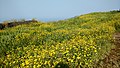 Senecio bombayensis---Sonki
 -
 Walking along eastern ridge


See also
[edit]References
[edit]- ^ Mahara shtra State Gazetteers: Ahmednagar. Directorate of Government Print., Stationery and Publications, Maharashtra State. 1974. p. 5.
- ^ "Trek to Ratangad: Jewel of Forts | Pune | MeraEvents.com". Archived from the original on 2016-12-20. Retrieved 2025-02-16.
- ^ "रतनगडावरचा रिद्धी-सिद्धी गणेश". Maharashtra Times. 6 September 2016. Archived from the original on 20 December 2016. Retrieved 16 December 2016.
External links
[edit]- Travelogues: Trek to Ratangad
- Trek to Ratangad and Bhandardara Archived 2011-01-20 at the Wayback Machine
| Chhatrapatis (Kings) | |
|---|---|
| Peshwas (Prime ministers) | |
| Amatya & Pratinidhi (Councilors and viceroys) | |
| Women | |
| Maratha Empire | |
| Battles |
|
| Wars | |
| Adversaries | |
| Forts | |
| Coins | |