Wiki Article
Sandy Ridge, Alabama
Nguồn dữ liệu từ Wikipedia, hiển thị bởi DefZone.Net
Sandy Ridge, Alabama | |
|---|---|
 The James Spullock Williamson House, located in Sandy Ridge, is a Greek Revival-style plantation home. | |
 Sandy Ridge  Sandy Ridge | |
| Coordinates: 32°01′29″N 86°27′07″W / 32.02459°N 86.45191°W | |
| Country | United States |
| State | Alabama |
| County | Lowndes |
| Elevation | 384 ft (117 m) |
| Time zone | UTC-6 (Central (CST)) |
| • Summer (DST) | UTC-5 (CDT) |
| Area code | 334 |
Sandy Ridge, sometimes spelled Sandyridge, is an unincorporated community in Lowndes County, Alabama, United States.[1]
Demographics
[edit]| Census | Pop. | Note | %± |
|---|---|---|---|
| 1880 | 168 | — | |
| U.S. Decennial Census[2] | |||
Sandy Ridge appeared on the 1880 and 1890 U.S. Censuses, but was not separately returned in 1890. It has not appeared on the census rolls since.
Geography
[edit]Sandy Ridge is located at 32°01′29″N 86°27′07″W / 32.02459°N 86.45191°W and has an elevation of 384 feet (117 m).[1]
References
[edit]Municipalities and communities of Lowndes County, Alabama, United States | ||
|---|---|---|
| Towns | 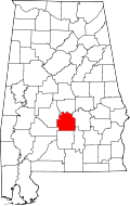 | |
| Unincorporated communities | ||
This Lowndes County, Alabama state location article is a stub. You can help Wikipedia by adding missing information. |