Wiki Article
Waikele, Hawaii
Nguồn dữ liệu từ Wikipedia, hiển thị bởi DefZone.Net
Waikele | |
|---|---|
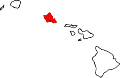
 Waikele  Waikele | |
| Coordinates: 21°24′9″N 158°0′20″W / 21.40250°N 158.00556°W | |
| County | Honolulu |
| State | Hawaii |
| Country | United States |
| Area | |
• Total | 1.10 sq mi (2.85 km2) |
| • Land | 1.10 sq mi (2.85 km2) |
| • Water | 0 sq mi (0.00 km2) |
| Elevation | 220 ft (67 m) |
| Population (2020) | |
• Total | 7,509 |
| • Density | 6,824.0/sq mi (2,634.75/km2) |
| Time zone | UTC-10 (Hawaii-Aleutian) |
| ZIP code | 96797[2] |
| Area code | 808 |
| FIPS code | 15-76250 |
Waikele (Hawaiian pronunciation: [vɐjˈkɛlɛ] ⓘ) is a census-designated place (CDP) in Honolulu County, Hawaii, United States. As of the 2020 census, the CDP population was 7,509. Residents use Waipahu, Hawaii for their postal city.
Geography
[edit]Waikele is located at 21°24′9″N 158°0′20″W / 21.40250°N 158.00556°W (21.4025524, -158.0058055). According to the United States Census Bureau, the CDP has a total area of 1.1 square miles (2.8 km2), all of it land.[3]
Demographics
[edit]| Census | Pop. | Note | %± |
|---|---|---|---|
| 2020 | 7,509 | — | |
| U.S. Decennial Census[4] | |||
Education
[edit]Hawaii Department of Education operates public schools. Waikele Elementary School is in Waikele CDP.[5][6]
References
[edit]- ^ "2020 U.S. Gazetteer Files". United States Census Bureau. Retrieved December 18, 2021.
- ^ "Waikele HI ZIP Code". zipdatamaps.com. 2023. Retrieved January 26, 2023.
- ^ "Geographic Identifiers: 2010 Demographic Profile Data (G001): Waikele CDP, Hawaii". United States Census Bureau. Retrieved May 29, 2012.
- ^ "Census of Population and Housing". Census.gov. Retrieved June 4, 2016.
- ^ "2010 CENSUS - CENSUS BLOCK MAP: Waikele CDP, HI" (PDF). U.S. Census Bureau. Retrieved October 9, 2020.
- ^ "Home". Waikele Elementary School. Retrieved October 9, 2020.
94-1035 Kukula St. Waipahu, HI 96797
Islands, municipalities, and communities of Honolulu County, Hawaii, United States | |||||
|---|---|---|---|---|---|
| CDPs |
|  | |||
| Other communities | |||||
| Government |
| ||||
This Hawaiʻi state location article is a stub. You can help Wikipedia by adding missing information. |