Plouay
| Plouay | |
 | |
| Verwàltung | |
|---|---|
| Land | |
| Region | |
| Département | Morbihan (56) |
| Arrondissement | Lorient |
| Kànton | Guidel |
| Kommünàlverbànd | Lorient Agglomération |
| Àmtliga Nàma | Plouay |
| Maire | Gwenn Le Nay (2014-2020)[1] |
| Code Insee | 56166 |
| Poschtlaitzàhl | 56240 |
| Iiwohner | |
| Iiwohner | 5.784 |
| Flech | 67,33 km2 |
| Bevelkerungsdicht | 78,33 Iiw./km2 |
| Làg | |
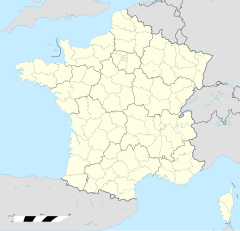
| Koordinate | 47° 54′ 53″ N, 3° 20′ 07″ W / 47.914722222222°N,3.3352777777778°WKoordinate: 47° 54′ 53″ N, 3° 20′ 07″ W / 47.914722222222°N,3.3352777777778°W |
| Heche | 78 m |
| Website | |
| http://www.plouay.fr | |
Plouay (bretonisch Ploue) isch e franzesischi Gmai im Département Morbihan in dr Region Bretagne.
D Gmai ghert zum Kanton Guidel un zum Arrondissement Lorient.
Geografi
[ändere | Quälltäxt bearbeite]Plouay lyt 52 km vu Vannes un 19 km vu Lorient uf ere Hechi zwische 13 m un 164 m iber Normalnull. Nochbergmaine sin Calan, Inguiniel, Quistinic, Bubry, Lanvaudan un Languidic.
Gschicht
[ändere | Quälltäxt bearbeite]Plouay isch zum erschte Mol gnännt wore anne 1281 as Ploezoe (1281: Ploezay, 1281: Plozay, 1308: Plozoe, 1308: Ploroe, 1516: Plouay, 1654: Ploe).
Verwaltig
[ändere | Quälltäxt bearbeite]Dr Maire vu Plouay isch dr Gwenn Le Nay. Plouay ghert zum Kommunalverband Lorient Agglomération.
Bevelkerigsentwicklig
[ändere | Quälltäxt bearbeite]| Johr | 1962 | 1968 | 1975 | 1982 | 1990 | 1999 | 2008 |
| Yywohner | 3.964 | 3.876 | 4.053 | 4.368 | 4.834 | 4.759 | 5.260 |
Dialekt
[ändere | Quälltäxt bearbeite]Dr traditionell Dialäkt vu Plouay ghert zum Bretonisch.
Böuwärch
[ändere | Quälltäxt bearbeite]- Chilche Saint-Ouen (um 1400)
- Kapäll Notre-Dame-des-Fleurs (1450-60)
- Kapäll Sainte-Anne-du-Scorff (16. Jh.)
- Kapäll Saint-Hubert (16. Jh.)
- Kapäll Saint-Sauveur (17. Jh.)
- Kapäll Saint-Sébastien (1878)
- Kapäll Saint-Vincent-Ferrier (19. Jh.)
- Kapäll Notre-Dame-de-Vrai-Secours, Ty-Henry (1625)
- Kapäll Notre-Dame de Grâce, Locmaria
- Château de Kerdrého (15. Jh.)
- Château de Kersily ou Kerstilly (15. Jh.)
- Château de Ménéhouarne (1460)
Weblink
[ändere | Quälltäxt bearbeite]- Plouay uf geobreizh.com (Internet-Archive)
Fueßnote
[ändere | Quälltäxt bearbeite]- ↑ Liste des maires au 25 avril 2014 (data.gouv.fr)
