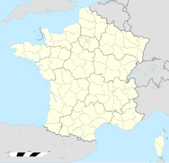
Saint-Philibert (Morbihan)
| Saint-Philibert | |
 | |
| Verwàltung | |
|---|---|
| Land | |
| Region | |
| Département | Morbihan (56) |
| Arrondissement | Lorient |
| Kànton | Auray |
| Kommünàlverbànd | Auray Quiberon Terre Atlantique |
| Àmtliga Nàma | Saint-Philibert |
| Maire | François Le Cotillec (2014-2020)[1] |
| Code Insee | 56233 |
| Poschtlaitzàhl | 56470 |
| Iiwohner | |
| Iiwohner | 1.580 |
| Flech | 7,05 km2 |
| Bevelkerungsdicht | 226,1 Iiw./km2 |
| Làg | |
| Koordinate | 47° 35′ 12″ N, 3° 00′ 00″ W / 47.586666666667°N,3°WKoordinate: 47° 35′ 12″ N, 3° 00′ 00″ W / 47.586666666667°N,3°W |
| Heche | 9 m |
| Website | |
| http://www.saintphilibert.fr | |
Saint-Philibert (bretonisch Sant-Filiberzh) isch e franzesischi Gmai im Département Morbihan in dr Region Bretagne.
D Gmai ghert zum Kanton Auray un zum Arrondissement Lorient.
Geografi
[ändere | Quälltäxt bearbeite]Saint-Philibert lyt am Atlantik, 19 km vu Vannes un 33 km vu Lorient uf ere Hechi zwische 0 m un 26 m iber Normalnull.
Gschicht
[ändere | Quälltäxt bearbeite]Saint-Philibert isch zum erschte Mol gnännt wore anne 1695 as Lophilibert (1830: Saint Philibert).
Verwaltig
[ändere | Quälltäxt bearbeite]Dr Maire vu Saint-Philibert isch dr François Le Cotillec. Saint-Philibert ghert zum Kommunalverband Auray Quiberon Terre Atlantique.
Bevelkerigsentwicklig
[ändere | Quälltäxt bearbeite]| Johr | 1962 | 1968 | 1975 | 1982 | 1990 | 1999 | 2008 |
| Yywohner | 860 | 843 | 1.037 | 1.020 | 1.187 | 1.258 | 1.477 |
Dialekt
[ändere | Quälltäxt bearbeite]Dr traditionell Dialäkt vu Saint-Philibert ghert zum Bretonisch.
Böuwärch
[ändere | Quälltäxt bearbeite]- Chilche Saint-Philibert (17./18. Jh.)
- Fort de Kernevest (1885)
- Lyychtduurm Kernevest (1854-56)
- Dolmen de Kervehennec (Neolithikum)
- Menhir Men-Milene-de-Pourhors (Neolithikum)
- Dolmen de Kerran (Neolithikum)
Weblink
[ändere | Quälltäxt bearbeite]- http://www.saint-philibert-morbihan.eu
- Saint-Philibert uf geobreizh.com (Internet-Archive)
Fueßnote
[ändere | Quälltäxt bearbeite]- ↑ Liste des maires au 25 avril 2014 (data.gouv.fr)
