Guatapé
| Guatapé | |||

| |||
 Blason |
 Drapeau |
||
| Administration | |||
|---|---|---|---|
| Pays | |||
| Département | |||
| Fondation | 1811 | ||
| Alcalde | Mauricio Alejandro Hernandez J. 2012-2015 | ||
| Code DANE | 05321 | ||
| Démographie | |||
| Gentilé | Guatapenses Guatapeños |
||
| Population | 5 800 hab. (2005[1]) | ||
| Densité | 84 hab./km2 | ||
| Géographie | |||
| Coordonnées | 6° 14′ 00″ nord, 75° 00′ 00″ ouest | ||
| Altitude | 1 925 m |
||
| Superficie | 6 900 ha = 69 km2 | ||
| Localisation | |||
 Carte de Guatapé | |||
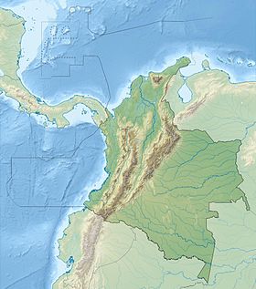
| Géolocalisation sur la carte : Colombie
Géolocalisation sur la carte : Antioquia (relief)
| |||
| Liens | |||
| Site web | www.guatape-antioquia.gov.co | ||
| modifier |
|||
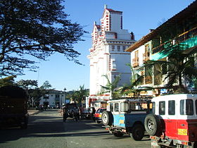
Guatapé est une municipalité située dans le département d'Antioquia, en Colombie, dont le Peñón de Guatapé constitue l'une des principales attractions touristiques.
Références
[modifier | modifier le code]- ↑ (es) Censo 2005 — Guatapé[PDF], DANE
Articles connexes
[modifier | modifier le code]Liens externes
[modifier | modifier le code]- (es) « Site officiel »


